Monthly Archives: December 2013

New Zealand- Always A Day Ahead

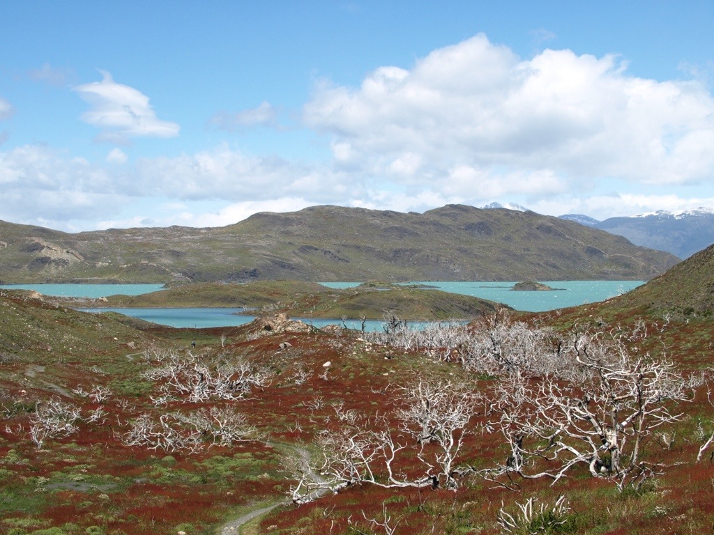
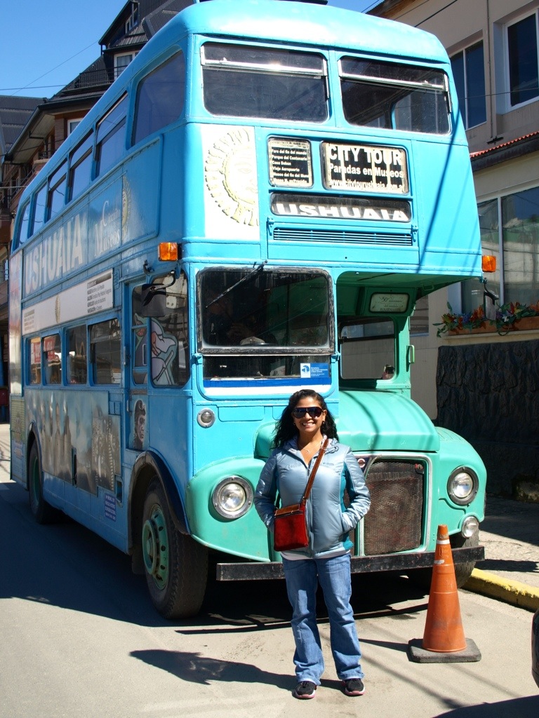
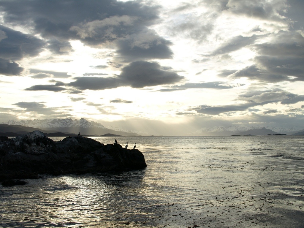
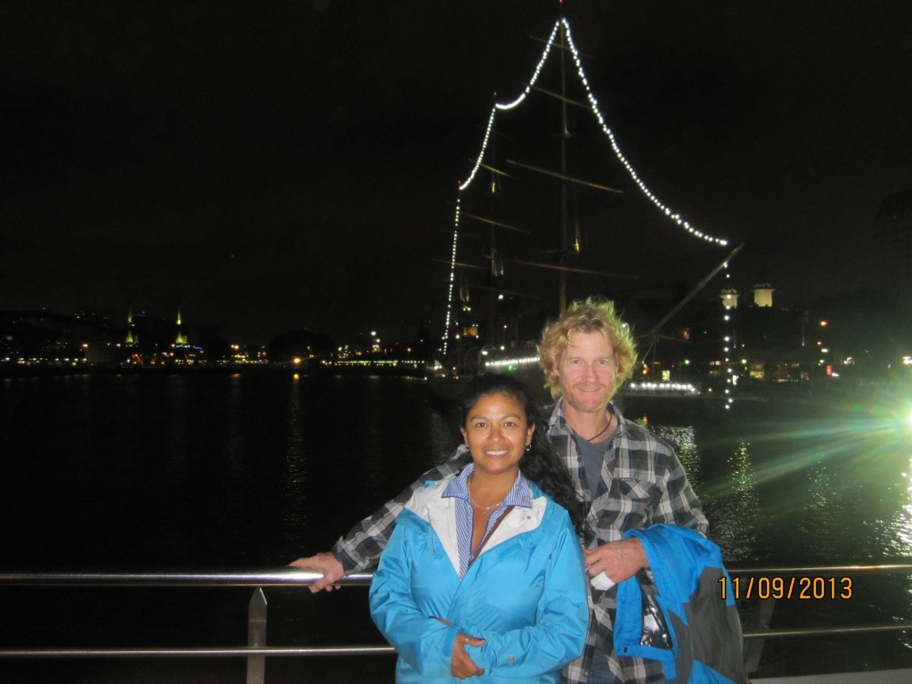
(New Zealand – 27 December 2013) In one sense, boarding a plane and leaving South America for New Zealand was just another flight in our journey around the world. Psychologically, however, the shift was as large as the Pacific Ocean we were crossing. We hadn’t consciously divided up our trip into parts or phases, but concluding 4 months in Central and South America and heading to New Zealand/Australia certainly provided a natural partition. Coming to grips with the fact that one-third of our trip is now over was hard enough to wrap our minds around. Anticipating our next five countries… (New Zealand, Australia, Indonesia, Singapore and China) …equally as bewildering.

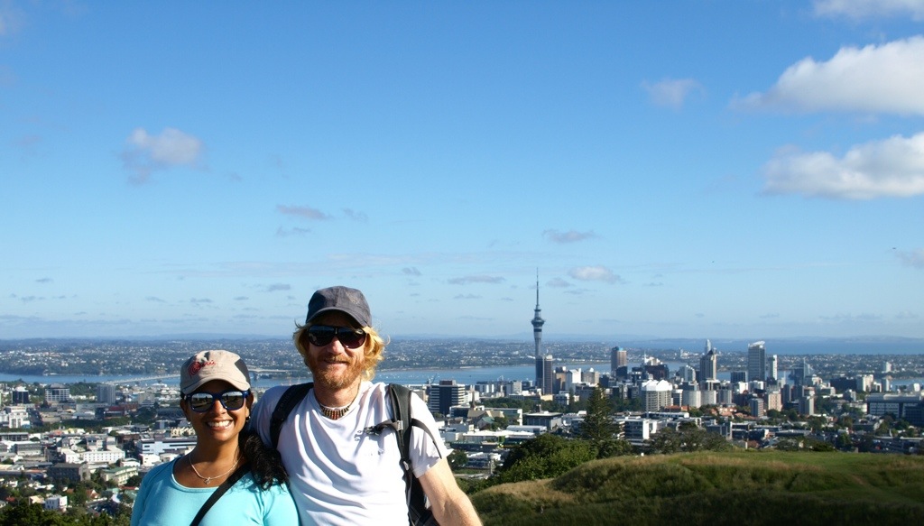
Our first introduction to New Zealand came in the form of Auckland, located on the northern end of the North Island. (New Zealand as a whole is made up of a chain of islands (much like Hawaii). The two main islands are simply referred to as the North and South islands.) We found Auckland to be very nice- clean streets, lots of flower-filled parks, and light traffic. The two most jarring things to us were the keep left roads and the high price of just about EVERYTHING.

20140104-223207.jpg

Delayed Flight for the Win

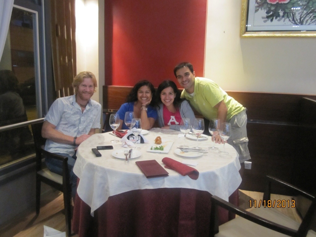
Travel mishaps often provide fodder for OMG stories involving multi-day delays, tarmac campouts, or airport sleep-overs, etc. The travel mishap story we have to tell is far happier. Our flight from Concepción, Chile to Sydney (the first of three stopovers on our way to Auckland, New Zealand) was delayed a few hours. The delay caused us to miss our first connection, so Quantas Airlines gave us the super sad news they’d be buying our lunch, AND putting us up in a Sydney hotel for the night. In addition, they gave us both $50 vouchers for food purchased at the hotel! Score!

Having stayed in a series of hostels (of wildly varying quality) practically every night since the beginning of our trip, the mere thought of staying in a nice hotel got us extremely excited. While not over-the-top fancy by any normal measure, the hotel felt like luxury to us. And then the buffet breakfast the next morning? Fugetaboutit! It was opulent. I swear they had 9 different kinds of bread, 10 different hot-plates, and more fruits and cereals than a grocery store. The cost of the buffet was $26 each, but Jessica and I used our vouchers and enjoyed the heck out of that spread for FREE.

The icing on the cake was that our reshuffled travel arrangements landed us into Auckland 8 hours earlier than our original flight plan. Thank you, Quantas! You can delay our flight anytime.

Keep Left

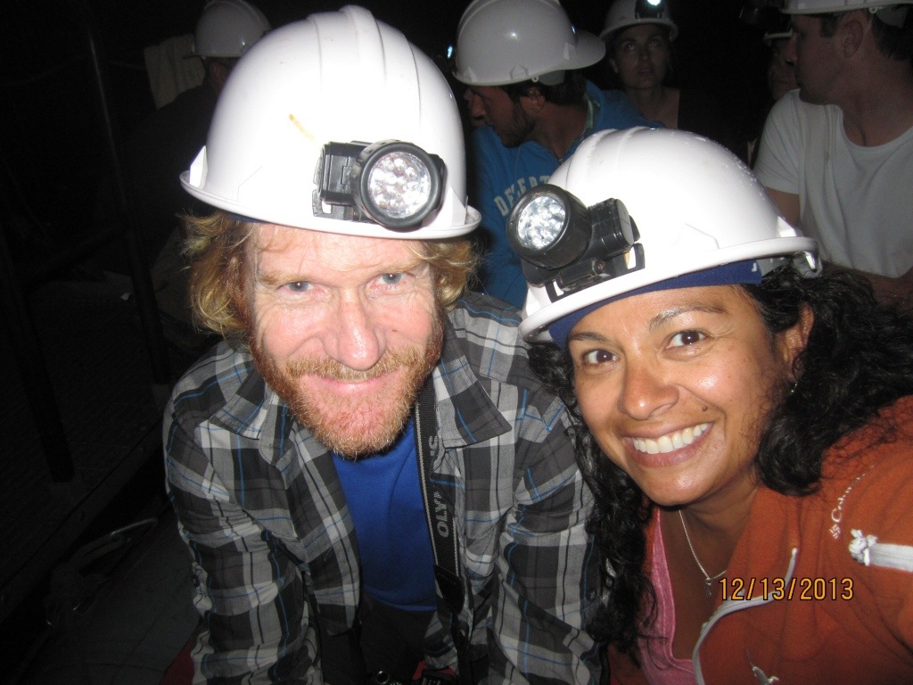
Up to this point, all of our travels had been on planes, trains, boats, taxis…and countless buses, but no rental cars. Our pattern might have continued still were it not for the high cost of bus travel in New Zealand. (South America, this ain’t!) The reason for renting a car was to see the glow worm caves located near Waitomo, an out-of-the-way town some 3 hours south and west of Auckland. That meant at least 6 hours of our day would be spent on the (left side of the) road, but we heard the glow worms caves were “mind blowing” so this meant seeing them regardless of cost or hardship.

It’s so weird driving on the left side of the road; a lifetime of “keep right” flipped on its bloody bum. Both Jessica and I were nervous as I drove away from the rental car place…and onto the left side of the road. One slip of attention and I could revert to my old keep right habits. Right turns were especially nerve-racking. Sweeping through an intersection to make a right turn just feels wrong.

I was also thrown off by the location of our rental car’s turn signal- on the right side of the steering wheel. Again and again, I turned on the windshield wipers by mistake…causing me to exclaim, “Dog-adee-doo!” (I’ve never been good at real swear words.)

Glow Worms- Like Nothing Else In This World

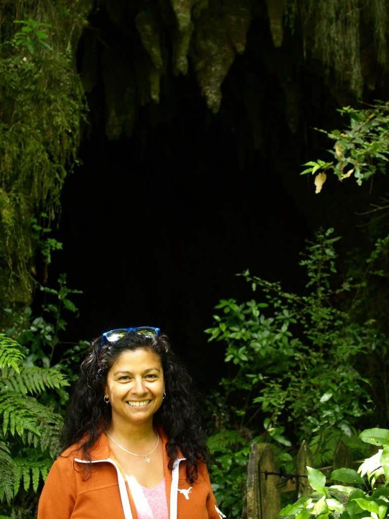
Our glow worm excursion included two cave treks. The first cave was more notable for its cool air and exquisite formations than for glow worms, though we did see some. Just points of faint green light on the ceiling of the cave. How can this be a worm? Further into the cave we saw more of them, and up close, too. That’s when our guide explained more about these strange creatures.

Jessica at the first cave’s entrance and while inside…

20140103-111316.jpg
20140103-111208.jpg

Only the tail of the glow worm does the glowing. The rest of the wiggly resembles a small thin brownish caterpillar and is about 1 1/2 inches long. Each worm stakes out a small bit of ceiling territory along favorable portions of the cave. 10 – 15 worm-spun sticky threads are lowered from each worm’s lair. Flying insects that happen through the dark cave will be drawn to the glowing light of the worm’s tail and then get hung-up in their threads. Bam! Mealtime. The glow worms are actually fly larvae and live as worms for almost a year before becoming flies (through metamorphosis). As flies they live only about 4 to 5 days. But in that time, they will have lots of sex. They don’t even have to stop for food since glow-worm flies have no stomachs.

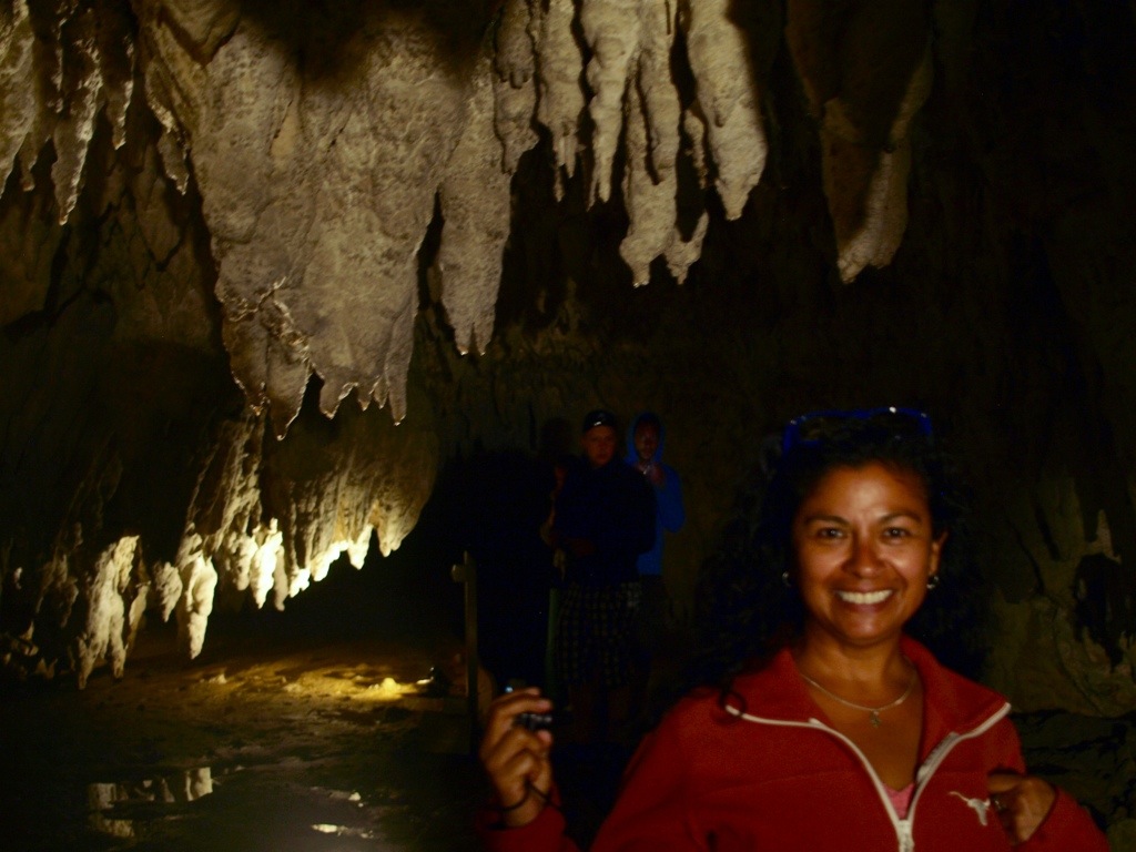
The second cave we entered was a short, picturesque nature-walk from the first and that one turned out to be glow worm central. Just the right temperature, just the right humidity, air flow, bug flow…whatever it was, the glow worms were loving it. The jackpot was a stretch of cave flooded by water. To see it, our group of seven (six tourists plus the guide) took seats in a small inflatable raft already docked inside the cave. We were asked to turn off all headlamps, flashlights and cameras; total darkness was needed to allow our eyes to fully adjust to the conditions. Below is one last pic in the raft before lights out.

20140103-111742.jpg

Not a soul spoke as we drifted through the cave tunnel, heads gazing upwards in amazement. Hundreds of thousands of greenish glowing points of light illuminated our “sky.” Some glow worms shined more brightly than others, just like the stars. Unlike stars, there was no twinkle; these points of light glowed steady and strong. The whole scene was magical to the point of questioning, is this real?.

20140103-111056.jpg

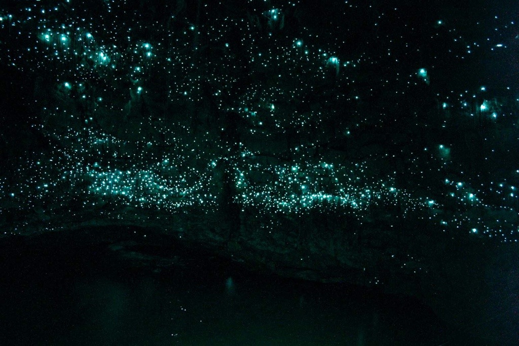
Our raft slowly floated only a short distance before turning around in place. The white-noise of flowing water within the cave was getting louder and turning back felt nice. Our guide controlled the boat by walking his hands along on a rope strung over our heads, a silent method that allowed our minds to drift, float and wander undisturbed. Back upstream we floated, still gazing in awe, to the dock where we started and then a few meters beyond. The eerie river of glow worms overhead appeared endless. Our guide spoke just a few times, once asking us to notice how much more our eyes had adjusted to the light. It was true, after additional minutes had passed we could not only see more glow worms, but we could see just how much their collective light illuminated all of our surroundings. The experience lived up to the hype; it was indeed mind-blowing.

A close-up that shows the sticky threads.

20140103-111004.jpg

Boris and the New Zealand Whirlwind

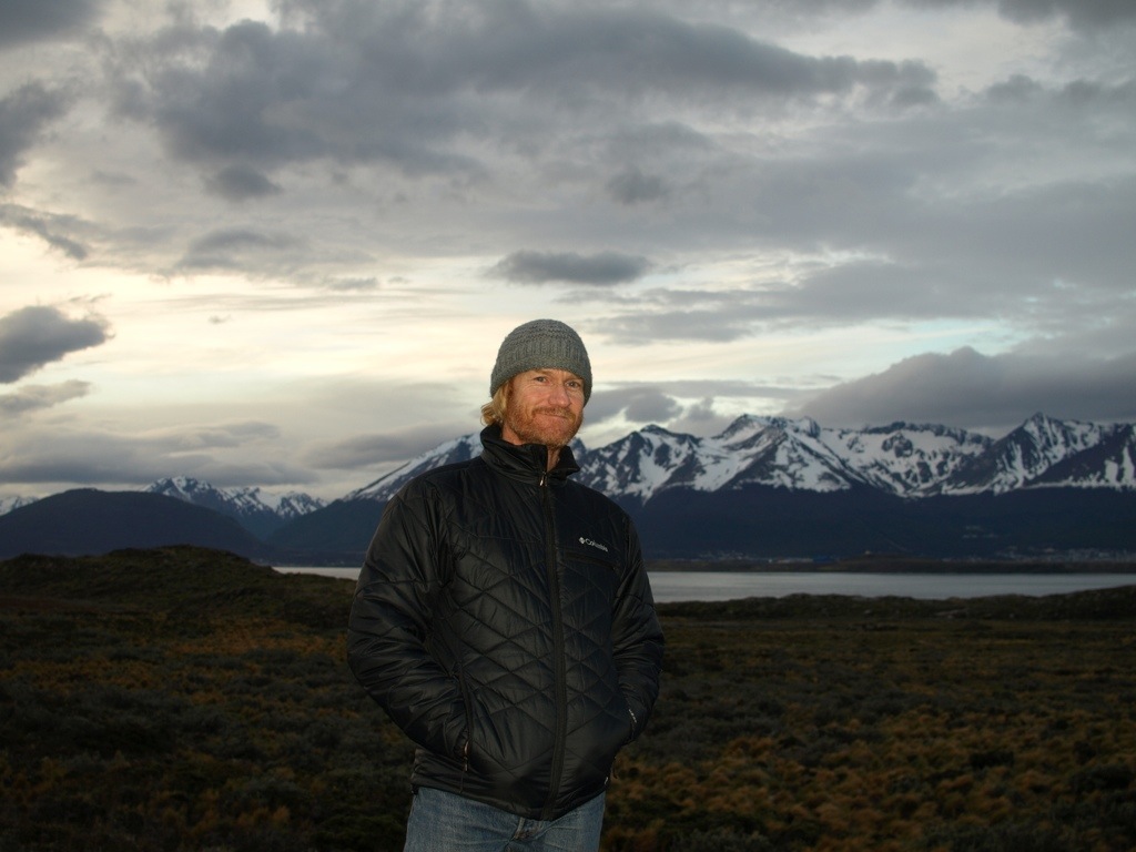
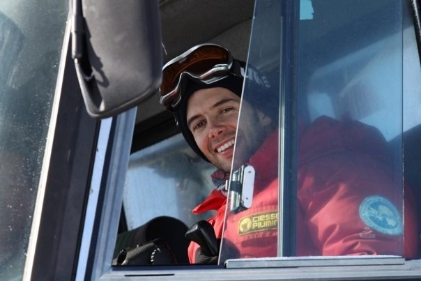
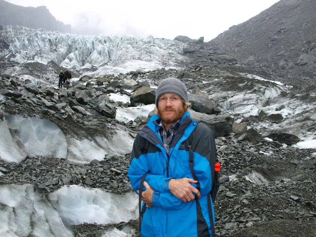
From the day Jessica and I announced our plans to travel the world for a year, we let all of our family and friends know how thrilled we would be if any of them (any of you) were to meet up with us somewhere along our journey. The first person to take us up on that invitation was our very good friend, Boris. Even if you haven’t met him in person, surely you’ve heard of his grand exploits. Boris is the Italian friend that I met in Austin in 2004 while (we were both) training for the Austin Marathon. He was in Austin for 10 months during that time to do research at UT as part of an exchange program connected to his PhD studies. All good stuff, but that’s just boring background for his real claim to fame. In 2010, Boris spent an entire year living and working at a research base in Antarctica. Yes, that frozen white continent on the bottom of the globe. Below is the quintessential “Boris in Antarctica” photo.

20140103-112401.jpg

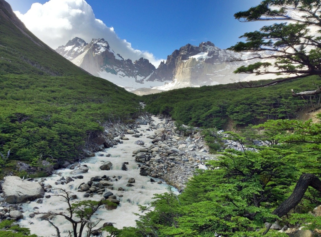
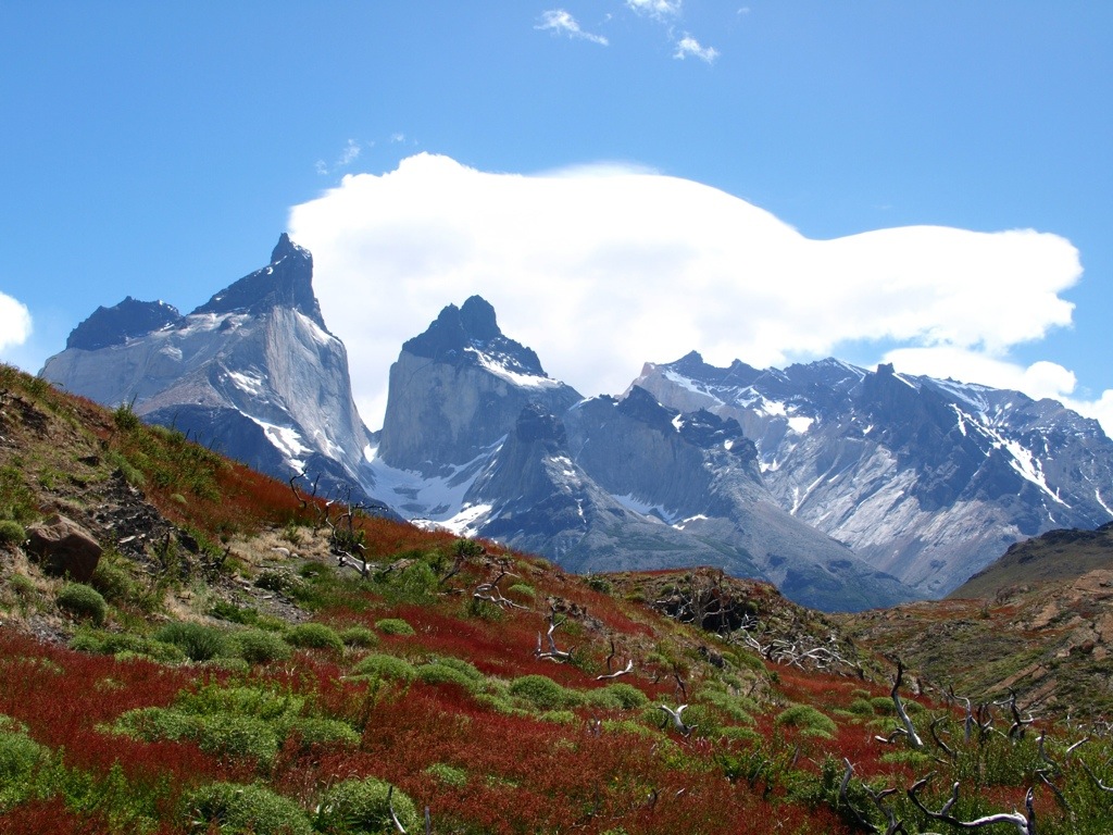
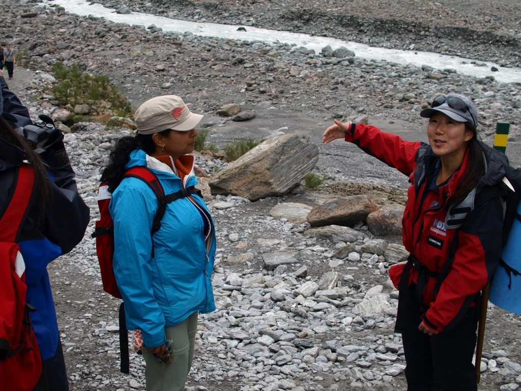
It was at the Auckland airport that we united with Boris and his Chinese girlfriend, Yufang. From there the four of us flew to Christchurch on the South Island to begin where all of our time together would be spent. From Christchurch on the east coast, we crossed New Zealand to the west by rental car and spent our first night in Franz Josef, (home of the Franz Josef glacier). This was the first arc of would be an awkwardly shaped counter-clockwise loop of New Zealand’s south island. The loop included stops at the Fox Glacier (up the road from Franz Josef), a sleepover in Haast, two nights in the uber-charming city of Queenstown, another two on the lip of Milford Sound, a night in Dunedin- where we stumbled upon the steepest street in the world (Baldwin Street), Oamaru- home of the yellow-eyed and blue penguins, Lake Tekapu- where we spent Christmas Eve and Christmas. The final swing of our loop took us back northward to Christchurch, where we visited the Antarctic Center. With the exception of the moderately famous Milford Sound, none of these place-names are likely to mean much of anything to you. Nevertheless, I wanted to put them down for my own memory’s sake. It was a bit of a whirlwind, really.

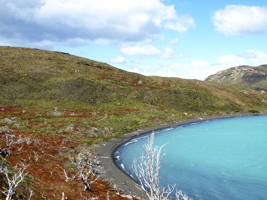
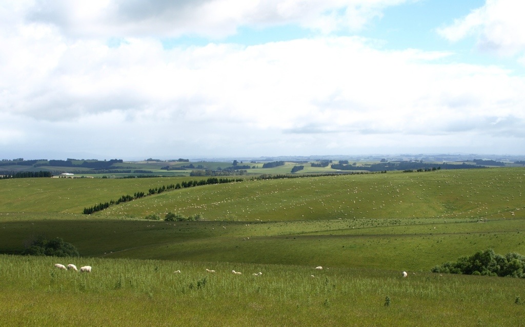
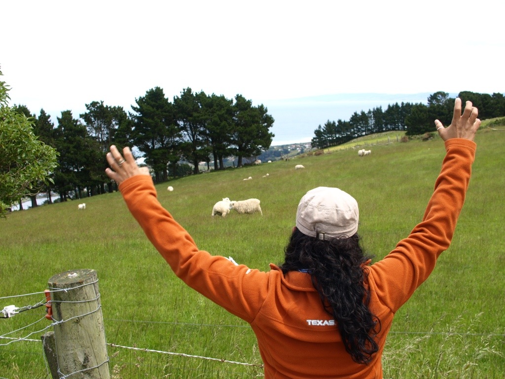
About New Zealand….well, it’s beautiful. The whole country looks manicured like a golf course. Must be those 36 million lawn-munching sheep keeping things tidy. We saw expansive meadows filled with happy sheep nearly everywhere we went.

Typical roadside scenery. (Yes, each white dot is a sheep.)

20140103-112959.jpg

Jessica gives them a holler.

20140103-113155.jpg

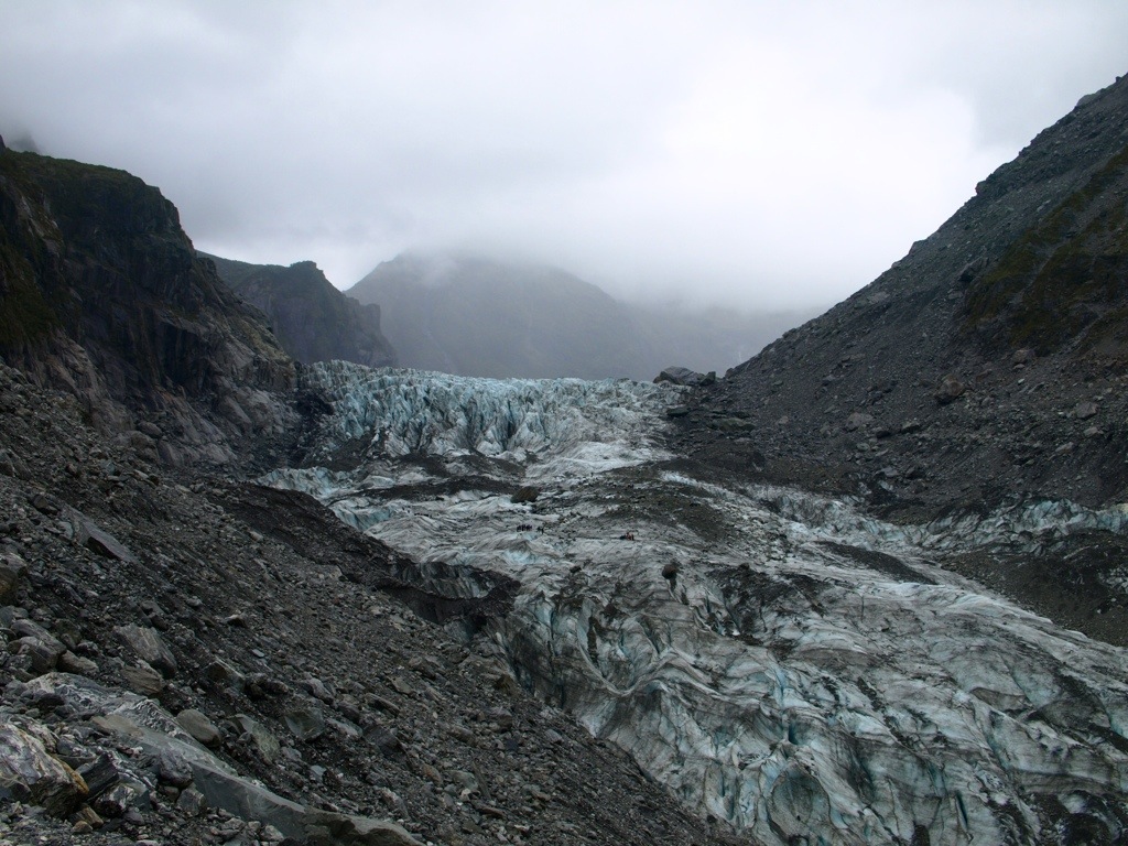
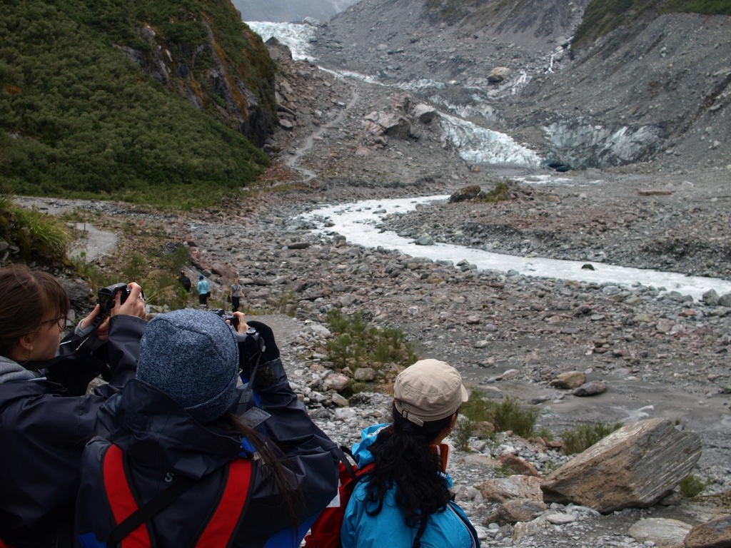
We saw zero sheep when we hiked the Fox Glacier. There are three groups of hikers already on the glacier as we approached. Spotting them will help you capture the enormous size of it. (Click on any photo to view it full size)

20140103-113502.jpg

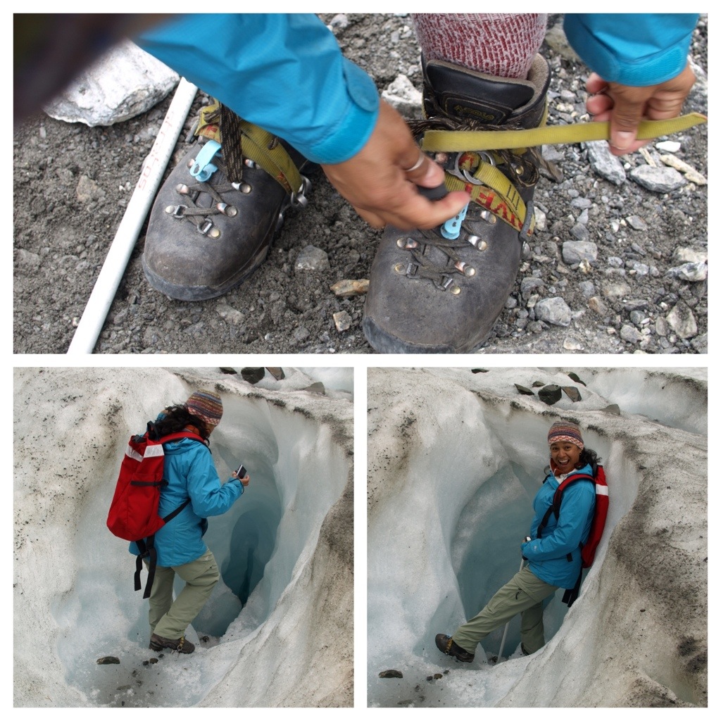
Walking on a block of ice was a cool experience. It wasn’t a particularly cold day, but once you step out onto the glacier it’s like opening the door to the freezer and climbing inside.

20140103-113730.jpg

Wear your crampons, friend. You wouldn’t want to slip and fall down a crevasse.

20140103-113923.jpg

The glacier carries tons of rocks with it as it slowly flows down the mountain…at a rate of about 1 1/2 meters per day. Like almost all of the world’s glaciers, this one is melting fast. It’s flowing down hill, but shrinking at the same time at an even faster rate. The result is that the glacier “retreats” all the while technically moving forward. Our guide showed us where it ended just a few years ago- about where we are standing in the second photo. The foot of the glacier as it currently resides is seen in the distance. The river of glacier melt flows past us in the foreground.

20140103-114114.jpg
20140103-122701.jpg

Ice vid from the glacier hike:

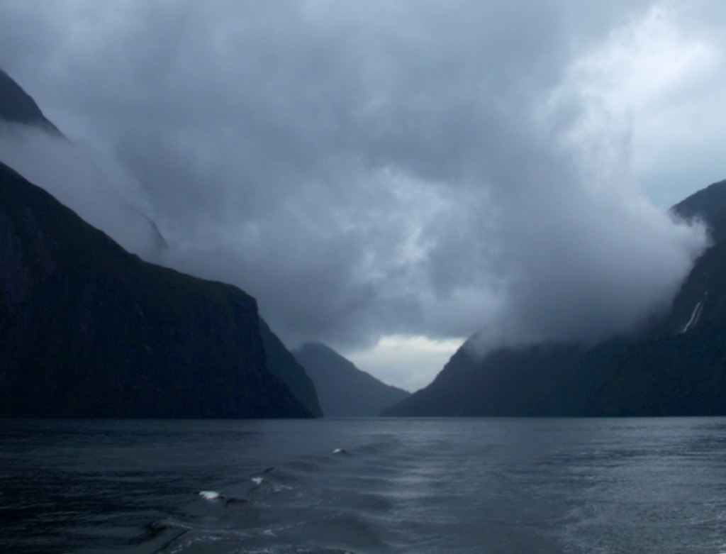
Milford Sound or Milford Fjord?

We visited the famous Milford Sound on two consecutive days. On the first day we arrived in the afternoon after driving towards our goal at a deliberately lazy pace, stopping for many worthy sites along the way- Mirror Lake, The Chasm Walk, Homer Tunnel, and more. We were in no particular hurry anyway. Once we arrived, the weather was superb and the waters of the sound shimmered beautifully. Though too late in the day to do much except ooh and ahh over the scene before us, we scoped out the plan for our return the following morning.

20140104-152816.jpg

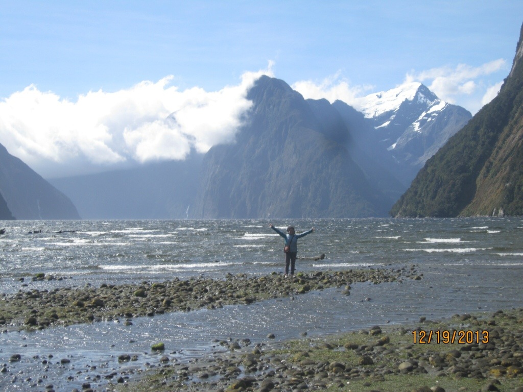
What is Milford Sound? First of all, it’s not actually a “Sound” at all, it’s a fjord, and, thus, inaccurately named. A fjord is created when a glacier flows out of a mountain range and into a neighboring sea, carving out a big trench as it inches along. Then, upon the glacier’s retreat, sea water follows inland behind its surrender. A sound can look geologically similar, but is not created by a glacier.

A 9 am boat cruise through the fjord was agreed upon despite the weather forecast that said overnight rains were virtually assured. The upside was that a good rain meant thousands of temporary waterfalls would streak down the mountains carrying rainwater into the fjord. How true this was! That next morning we saw waterfalls out the wazoo. The mountains lining Milford Sound are steep and high and the rains streamed down from on high like icing on a bundt cake.

A quick look at the water streamers before dashing into the Homer Tunnel.

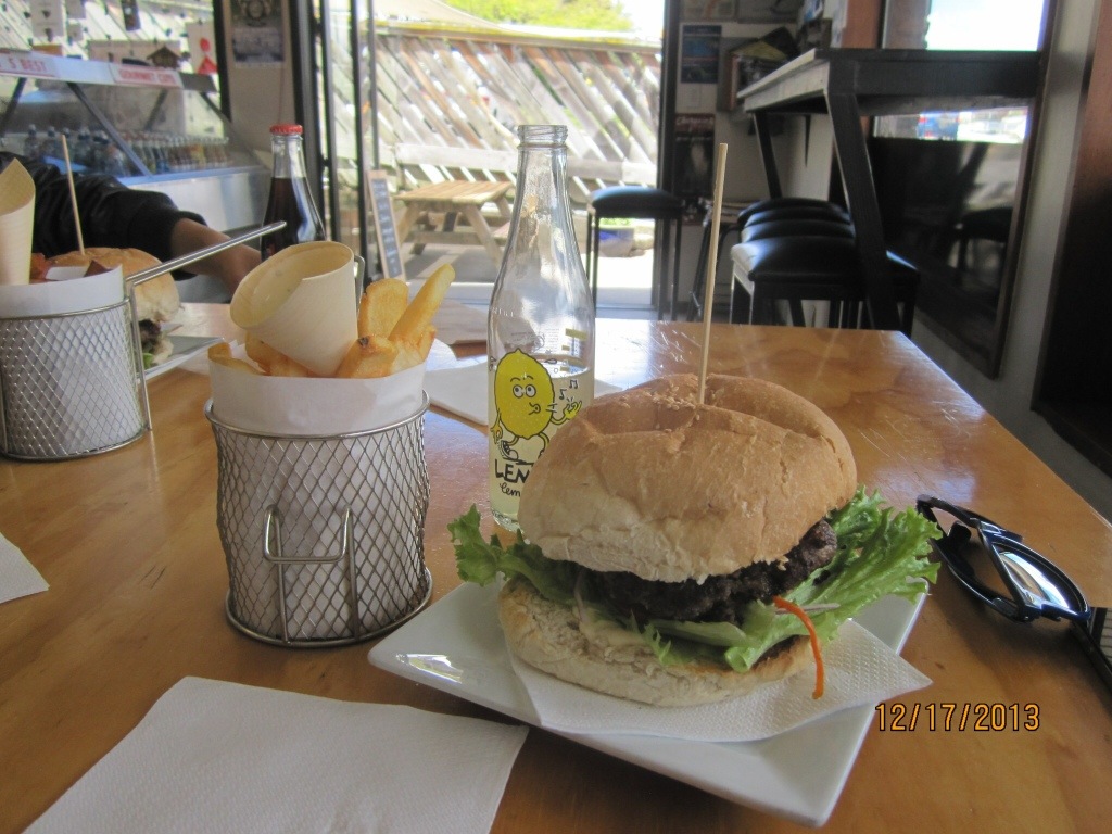
$14 for a Hamburger?!

I mentioned earlier that New Zealand is expensive. The “land of thieves,” Boris liked to call it. He warned us that Australia would be that way, too. For this reason, we ate out only occasionally and mostly bought food at local grocery stores to cook in the hostels. Even that wasn’t cheap, but far less costly than eating out. We did “splurge” every so often. For example, we stopped for lunch in a small town called Wanaka. After walking the main street for a couple of blocks we decided on a place with burgers and chips (“chips” are what they call french fries). $14 was the cost of a basic burger. And it’s not like we stopped at a fancy joint, either. It was just a regular little burger hut. Want a drink with your meal? That’ll be another $4.

Behold, the $14 burger:

20140104-153759.jpg

On another occasion we ate lunch at Wendy’s. (Yes, they have them here. Not many, but a few.) Our tab for two lunch combo meals was $24.

Prices like this quickly change the conversation when discussing things to do. The Lord Of The Rings trilogy was filmed in New Zealand and consequently LOTR tourism is understandably a big thing around here. But the prices of the excursions are insane. The complete movie set of the Hobbit’s shire (called Hobbiton) is available for tours and Jessica was itching for a visit. That itch went unscratched, however, once she saw the tour’s $124 price tag.

Internet access is costly here, as well. We’d become accustomed to free internet everywhere throughout South America. In New Z we had to pay various different annoying fees every time we wanted online and each hostel had their own unique method of robbing. Examples: $4 for 200 MB of data, $1 per 15 minutes, $5 per day. Not fast connections, either. This is one of the reasons this post has trailed the last by several weeks.

Christmas at Lake Tekapu

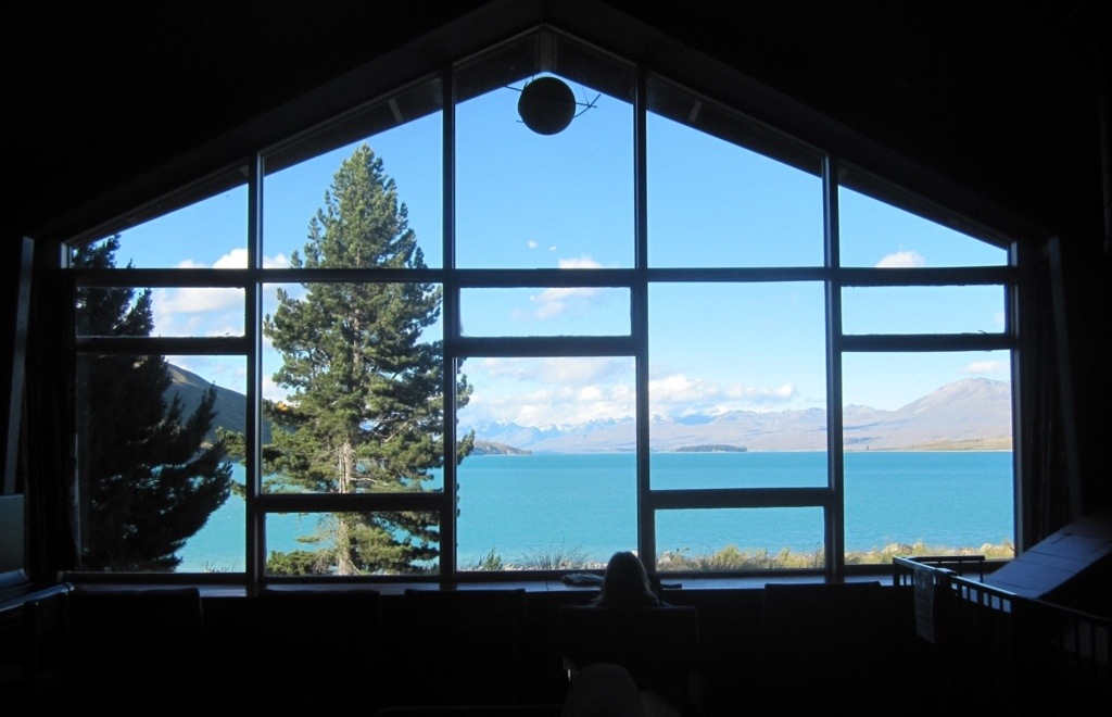
New Zealand is overrun with beautiful places; stunning views that are hard to look away from. Rarely, however, are the hostels where we stay located in the premium spots. The front row seats are typically occupied by the richy-rich hotels. To our delight, this was not true in the case of our hostel at Lake Tekapu. The view from the hostel’s common area:

20140104-153326.jpg

Christmas so far from home was different to say the least. We found the typical symbols of Christmas here and there (ie, Santa Claus, Christmas trees and lights), but being a home with family would be an irreplaceable missing element this year. Adding to the sense of apartness was the fact that our Christmas occurred a day ahead of all our family and friends back home.

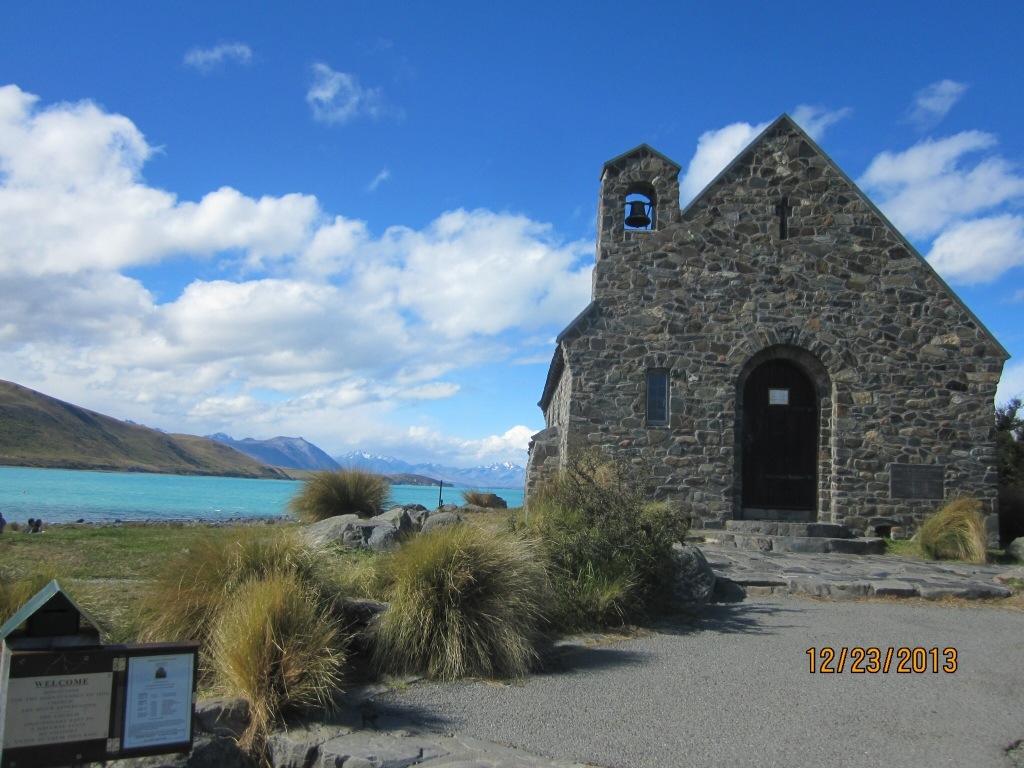
Though our Christmas wasn’t very Christmas-like in many respects, we did walk over to Lake Tekapu’s lone church on Christmas Eve to hear a few awkwardly sung carols. The church was miniature in size and even though we arrived early there was no more room inside. We stood patiently just outside the door (in the cold-blowing wind) and waited for the service to begin. Yufang, Boris’ girlfriend and the one person in our group with no trace of Christianity in their background, managed to slip inside the Church and find a sliver of a seat right there in the front pew. She had made her move quietly- like a ninja -and we didn’t know where she was for the longest time. Only after Jessica circled-around to the opposite side of the church and spotted her through the picture-window- pretending to sing along, lyric-pamphlet in hand -did we realize where she had gone.

I’m not much for God, church or religion, but visiting that quaint little church on Christmas Eve wan’t awful.

20140104-153501.jpg

Pics from Additional Stops Along Our Route
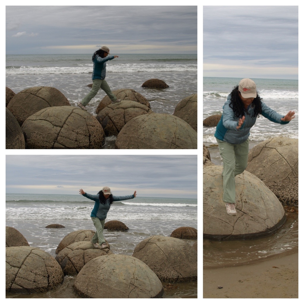
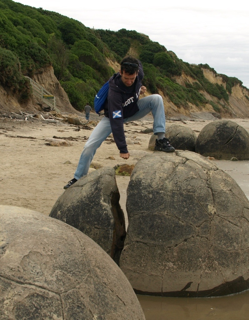
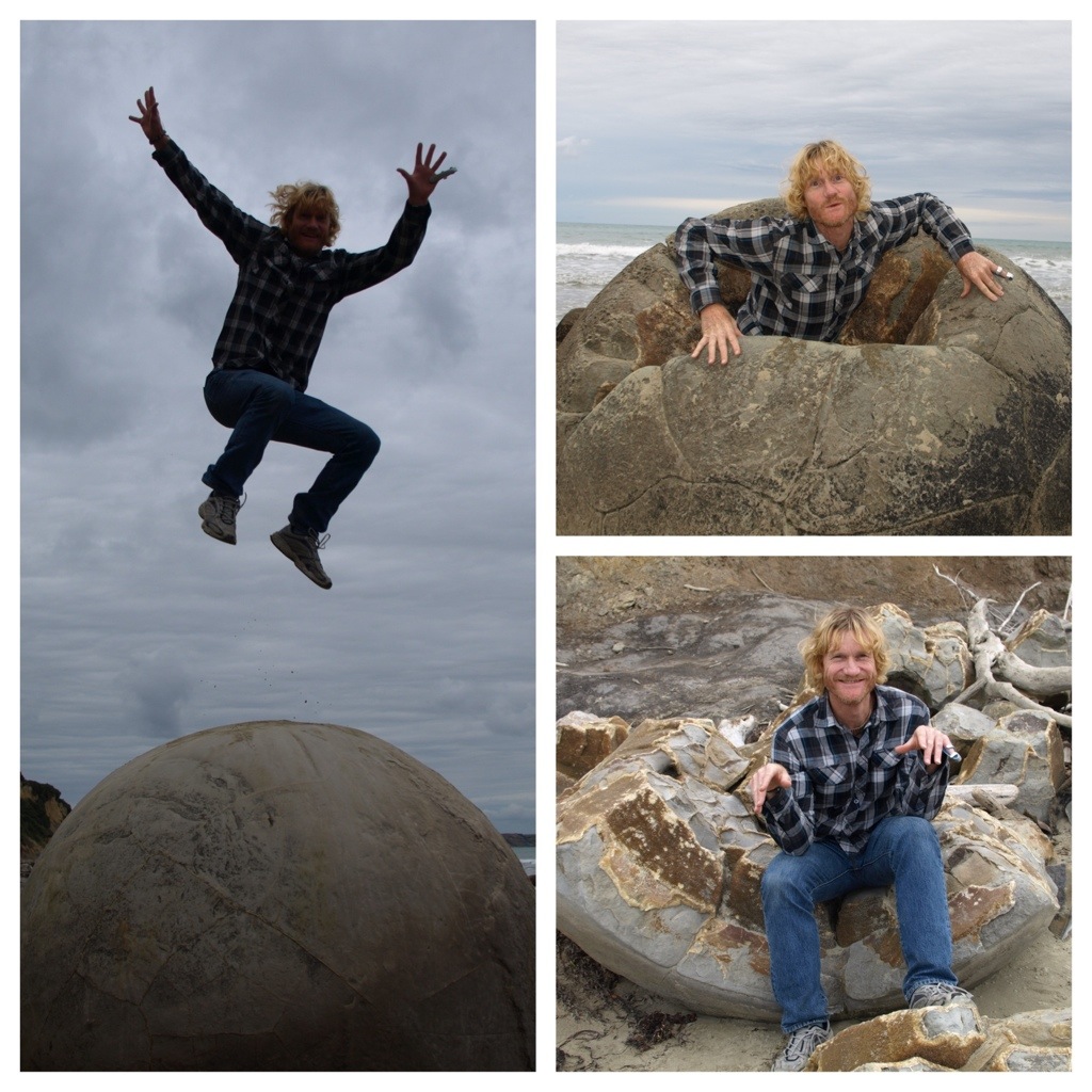
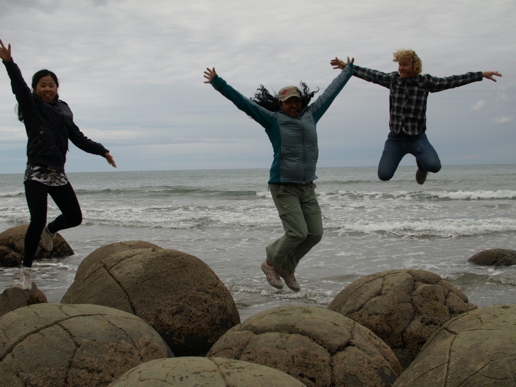
Moeraki Boulders

A fun stop to see the curiously round Moeraki Boulders near Oamaru. So very odd!

20140104-154100.jpg

20140104-154354.jpg

20140104-154807.jpg

20140104-154931.jpg

More from Milford Sound on the day of our sight-seeing cruise

20140104-155850.jpg
The permanent waterfalls were bulging with extra water from the rain.
20140104-155953.jpg
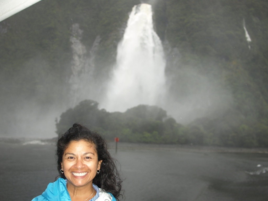
Fur seals frolic amid the raindrops.
20140104-160032.jpg
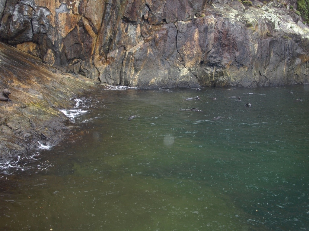
Temporary waterfalls streamed down from the heavens all around.
20140104-160314.jpg
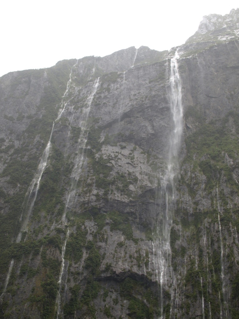
See the Chasm in action.

Nice Visit to the Antarctic Center
It was something like $35 per person! We debated whether or not to go for about an hour. Glad we finally sucked it up, paid the dang ticket and went.

20140104-162720.jpg
So quick in the water they are!
20140104-162739.jpg
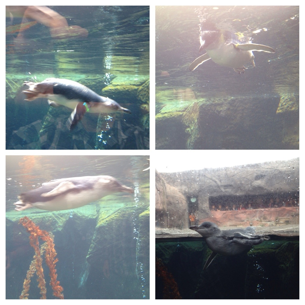
Animal feeding time.
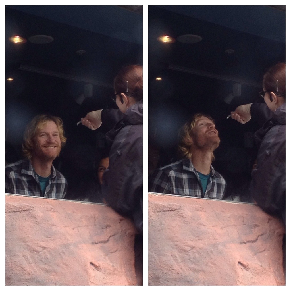
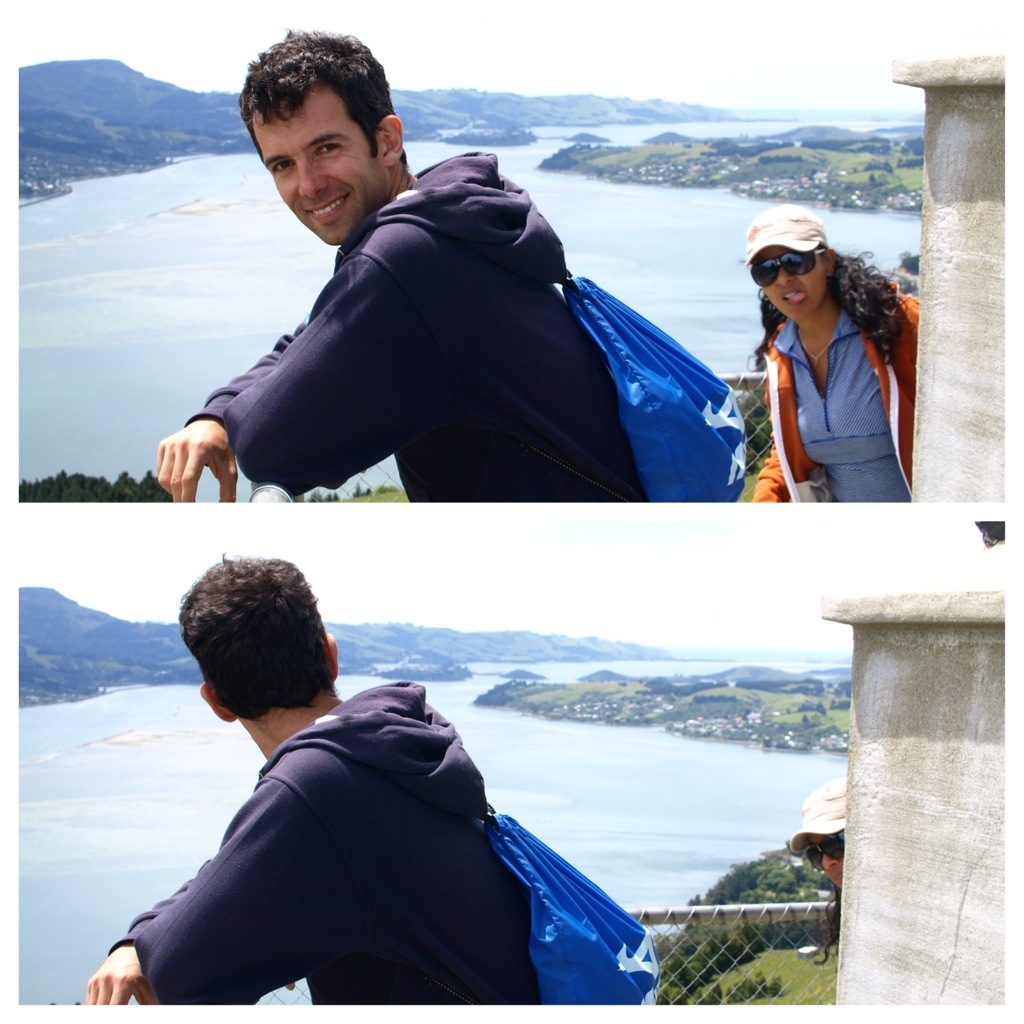
20140104-162752.jpg

Dunedin

Photobomber strikes Boris on the Pukehiki Pennisula.

20140104-163304.jpg

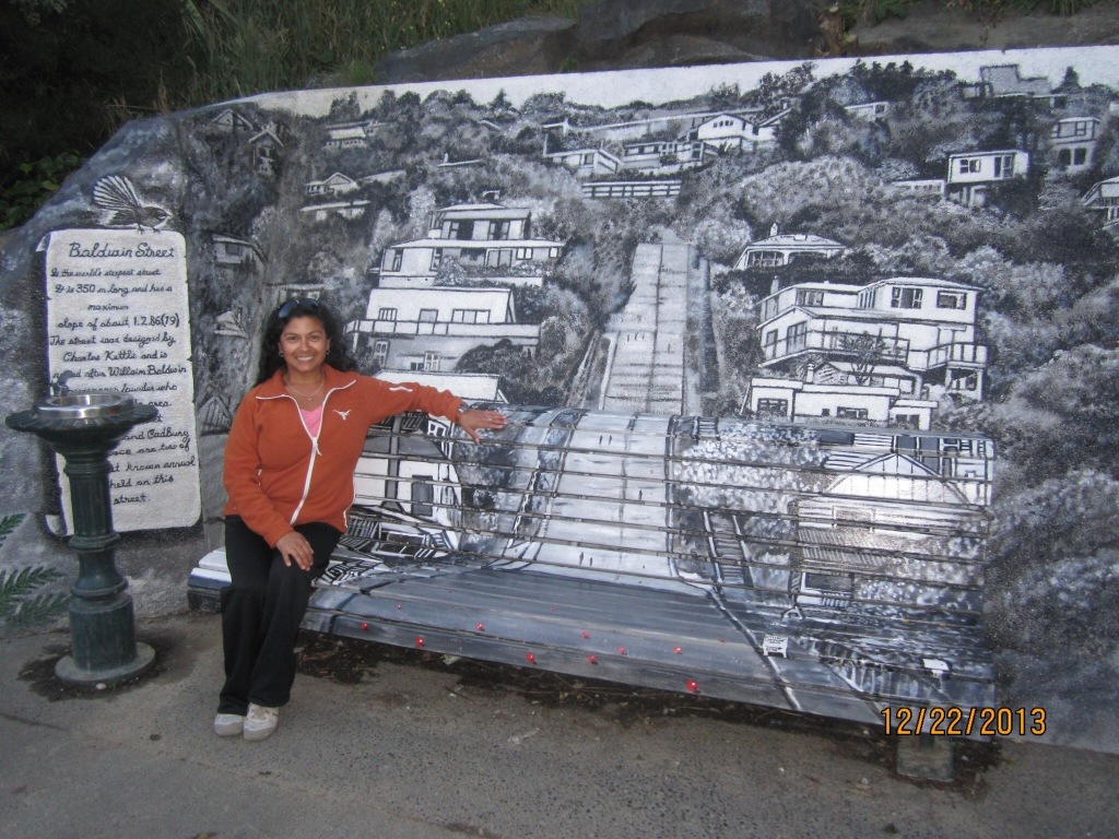
Baldwin Street- the steepest street in the world according to the Guinness Book of World Records.

20140104-163457.jpg
A bench for resting sits at the top of the street, creatively painted with an image of the street itself.

20140104-163527.jpg

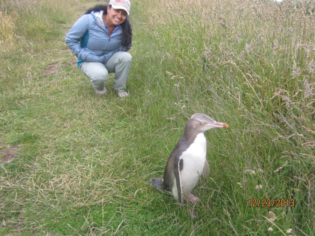
Hello little fella. (One of the Yellow-Eyed Penguins we spotted near Oamaru.)

20140104-224754.jpg

Next up, Australia. Hope you’ll stay with us.

Torres del Paine and the Hike of Our Lives

(Torres del Paine, Patagonia, Chile – 4 December 2013) I struggled through the pass first, ditched my pack behind a boulder and rushed back to help Jessica. Take my hand if you want to live was implied. If I had shouted it, the thunderous winds would have dispensed my words anyway. Jessica’s head was dipped low for protection against the onslaught. She wasn’t moving forward at all. Little bits of grit carried by the rushing air stung and punished too much.

We’d already hiked uphill for 7 hours that day fully weighted-down with our packs. Our legs were weak from overuse. This final high pass into the Torres del Paine valley was the last challenge of the day, a distance of just 20 meters or so. But the wind was (no exaggeration) hurricane strength and walking forward into its teeth was fighting a force field.

Jessica grabbed my arm and we slowly stepped forward together. Even united, we had to pause several times to find our balance before restarting again for the relative safety of the boulder ahead where the winds were still high but manageable.

The last two hours of our hike had been against some strong winds, but the strength and volume of angry flowing air at this highest pass was orders of magnitude greater. It caught us by surprise. We wobbled down from the pass bewildered and completed the remaining steps to the refugio, shaking our heads all the way and thinking, no one will believe this.

Torres de Paine

Torres del Paine National Park will mean absolutely nothing to the average person from North America. Neither Jessica nor I had ever heard of it until planning for this trip began. But twice it happened that we told people Chile was included in our travel itinerary and were asked, “Are you going to Torres del Paine?” Having never heard of the place at that time, I’m sure my response was, “Taurus del WHAT?” A fellow Ultimate player (Patrick Christmas) was one of the people who told us about it. I had him spell the name for me as I typed it into my phone. (I have a place where I jot down interesting travel tips when I hear them.)

There are multiple sites in southern Chile/Argentina (regionally known as Patagonia) that contain dramatic landscapes. However, it is hard to imagine any more varied and spectacular as Torres del Paine. A literal translation of the name into English fails. Better to convey what the name means: Towers in/from the Blue. The word Paine (pronounced ‘PINE-eh’) is the color blue in the local dialect, and refers to the blue-colored lakes that dot the area. Torres is, of course, the Spanish word for towers.

The actual torres are just one geological feature within this magnificent natural wonderland. As you will see from our pictures there are lakes of blue, green, and grey, massive glaciers, magical forests, radical snow-capped mountains, rivers, ravines, ridges, and waterfalls…lots of waterfalls. Completing a circuit in and around the various features are hiking trails. Campsites and shelters- called refugios -are widely dispersed along the circuit. The place is so huge that it takes multiple days to traverse on foot, the only option available to visitors since roads will only take you so far into the park.

Preparing for our visit to Torres del Paine was a massive (and expensive) undertaking. We had to:

    rent camping gear,
    reserve 2 spots in 2 refugios the last 2 nights
    buy enough food for the 6 days we’d be in the park,
    figure out how and when we’d get to and from the park entrance,
    arrange the boat ride that would deliver us to the starting point of our hike, and
    not forget ANYTHING.

Without Jessica’s superior organizational skills, I don’t think we would have been able to pull it off.

The “O” and the “W”

Many people enter the park in the morning, see what they can see, and leave the same day. The hardcore outdoor enthusiasts (like Jessica and me, (yeah right)), will hike one of two principle circuits- the “O” or the “W.” So named for obvious reasons once you’ve seen the trails on a map. The first “3D” map gives you a good view of the O, which includes the W within it.

20131216-145526.jpg

The red trail shown in this second map is the W. (Look closely at the map and you’ll see crudely drawn circled numbers on it. These correspond to the nights we spent in the park.)

20131216-193739.jpg

We chose to do the “W.” Perhaps “I chose” is more accurate since Jessica would have preferred five days at a luxury resort (or any resort) over five days camping in the wilderness, if that option had been presented to her. Yes, it was something I really wanted to do…an experience of a lifetime. And while Jessica would not have chosen it for herself she’s never one to pass up on experiences of a lifetime. And so, she cautiously embraced the challenge.

Our first night of camping was on Lake Pehoé, a point outside the start of our actual hike. From this vantage, we could see a large swath of the mountainous area we would be hiking in the days that followed. We also see one of the parks pricier hotels.

20131213-220621.jpg

To get ourselves onto the W circuit, we took a thankfully sturdy boat across Grey Lake to the drop-off point, located within close sight of Glacier Grey. Jessica breaks across the dry end of the lake in full pack. The boat awaits.

20131216-205128.jpg

Broken iridescent blue chunks of the glacier floated nearby. The headwinds created substantial waves that exploded over the bow of the boat repeatedly. We rode safely inside the cabin.

The waters calmed as we approached the glacier and passengers were allowed up top for some photo-ops.

20131213-215939.jpg

Degree of Difficulty: Hard

Our first day on the W was both heaven and hell. The spectacle of the glacier was mind-blowing. And this leg of the W had numerous spectacular views of it. But the hiking was steep in the up direction and our backpacks were at their heaviest (stuffed with 6 day’s worth of food). I misinterpreted the map and what I thought was going to be a 3 hour hike, turned into nearly six. Also, I completely missed the map’s trail difficulty rating chart, which clearly showed this portion of the W has the highest difficultly ranking. What a way to get started.

Crossing those ravines with the scary metal “ladders” was especially challenging for Jessica. Her legs are strong, but not that long; blindly finding the ladder rungs with her toes was not her idea of a good time.

20131213-220133.jpg

The hardest part was the uncertainty. When would we arrive at the campsite? How many more gorges must we cross? The hour grew later and we feared nightfall would find us before we found the camp. Jessica was at her wit’s end and I was struggling to stay positive myself. Finally, with about an hour of dusk left, we spotted an orange tent through the trees up ahead. We’d made it to Camp Paso.

The tent went up quickly. Dinner prep for our starving selves followed equally as fast. The campsite was primitive- no showers, no running water (other than the small stream that cut through middle of camp), and just one outhouse…sans toilet. Despite the hardships, we were glad to have survived day 1.

20131216-214406.jpg

Note to all: I won’t recount every step of every day on the trail, but I am keen to convey just how amazingly tough and stunningly beautiful this place is. Trudging these trails is not for the weak-hearted or weak-kneed, but the rewards of the natural landscape are abundant. There is hardly a place to tread in Torres del Paine that is not heavily imbued with wondrous views, and yet the extreme physical exertion and associated discomfort is a worthy adversary that competes for your constant attention. Great mental focus is required on many parts of the trail, too. It can be rocky, slippery, muddy, and steep….and many times all of those simultaneously.

Crossing a large ravine on a suspension footbridge.

Backtracking and Carrying Forward

Up early and refreshed the second day, we backtracked the left part of the W until we reached Refugio Grey where our hike had begun the previous day. Returning in the downhill direction shaved two hours off our hike. A bite of lunch later and we continued on for another 5 hours to Refugio Paine Grande. Once more, expectations played a large role in our psyche. We expected that our afternoon hike would take roughly 3 1/2 hours…the fact that it ended up taking 5 means we not only had to absorb the physical toll exacted by an all-day hike with full packs, but that we also did the “are we there yet?” dance. This is when you convince yourself it can’t possible be much further, but really….it is. Distances are so exaggerated at Torres del Paine; what looks to be not that far, can be practically unreachable.

As we hiked through the final valley that ultimately delivered us to the second campsite, strong winds pushed us along but also twisted us from side to side on the trail as it caught our backpacks. The wind followed us into camp and made great fun of our efforts to set up the tent. Jessica and I did pretty well, thanks in part to a couple of fellow hikers lending a hand. Some campers appeared to be wrestling alligators as the wind whipped their tents sharply. We saw others comically chasing pieces of their tent equipment that wasn’t thoroughly tied down.

Sleeping amid the howling and buffeting wind was not as challenging as you might guess; tired bodies will sleep, regardless.

The weather cleared by morning.

20131213-221141.jpg

Snickers in the French Valley

Our third day backpacks were a couple more meals lighter and the planned hike that day relatively easy. [Note, none of the hiking trails at Torres del Paine are “easy.”] We were headed only to Camp Italiano (for those following on the map) which sits mid-W. The sprawling camp was found just across a beautifully noisy tumbling river and half-hidden among tall trees. There we pitched our tent and knocked out another meal. Only the hike deeper and higher into Valle Francés remained and then the middle-stroke of the W would be complete. Jessica decided she’d hiked quite enough the past couple of days and would enjoy relaxing her muscles at camp while I continued into the valley alone and wearing only my day-pack.

My hike into the Valle Francés turned out to be a true highlight for me. The trail had so many terrain variations that my feet never knew what the next step would bring. Some parts were smooth and playful, while others downright jagged and angry. It was supposed to be 4 – 5 hour (round trip) trek, but with only my day-pack on, I was able to move quickly and would surely beat that estimate. The day-pack carried only my camera and an extra jacket. I didn’t have to carry water since I could use any trail-side stream as my water fountain. This was true throughout our entire hike, too. Whenever we needed water, I’d simply dip our canteen into a river to find fresh, clean, cold, delicious water. How cool is that?

20131213-215635.jpg

My view looking back down the valley from whence I came.

20131216-211237.jpg

Here is the selfie video I shot after reaching the scenic overlook at the end of my hike into Valle Francés. Apologies for the Snicker smacking.

Hiking Karaoke

We awoke the morning of our 4th day on the trail to a sprinkle of light rain and sleet. By the time we were up and moving about the tent all precipitation had turned to snow. Being from Texas, snow is a rarity in my life. Seeing that friendly snow drift down through the trees made me smile like a kid at Christmas.

Weather can span from snow to sleet to rain to sun and back again all within the same half-day. And you’ve already heard about that notorious wind. Supposedly, November and December are the two windiest months. That said, many sections of Torres del Paine are almost always windy. One fellow hiker we met said he’d never see a trail map with symbols for high wind in any other place except Torres del Paine.

Our hike on day 4 was another long one (similar to day 2). We mentally prepared ourselves for 8 – 9 hours on the trail. Aside from taking time out to enjoy the immense beauty around us, we also enjoyed a few rounds of hiking karaoke. This is where we each try to sing a song from start to finish. I didn’t pretty well belting out some Lovin’ Touchin’ Squeezin’ by Journey, while Jessica nailed Charley Daniels’ Devil Went Down to Georgia.

The final few hours of our day 4 hike were mostly uphill. Some steep, some only slightly elevated, but nonetheless, every single GD step was uphill. Towards the end, we weren’t singing anymore. Jessica had decided that W was officially her least favorite letter. And yet, just as we were the most exhausted….we approached the windy entrance into the final valley. Up and up we climbed against the harsh wind until we had reached the high pass.

The video below shows us nearing the windiest part…described in the opening, above. Capturing that drama with my phone’s camera would not have been possible; too dangerous.

Refugio El Chileno

We’d spent four consecutive nights in a tent. This night would be our first of two in a refugio (or refuge) and sweet reward after so much tough trekking. Refugios are not hotels, but they are more than simple shelters. They have a staff, a mess hall for eating, bathrooms with hot water for bathing, and a half-dozen rooms lined with bunk beds for sleeping. Once checked-in, Jessica and I were led down the hall to our room, one that we would share with six others. Three of those six were in the room at the time we arrived, a mom, dad and their early 20’s daughter, part of a family of four from California. We must have looked like hell coming through those doors.

The staff of the refugio pointed upwards to the bunks that would be ours…on the third bunk level. Jessica exhaled in disgust while speaking the words, “What the shit?” Followed by, “Oh well… what’s one more climb?” She felt kinda bad for swearing in front of these complete strangers, but she felt worse having to ascend to the third bunk-deck just to go to bed.

Breakfast the next morning was good but too light for the circumstances. We had burned a lot of calories recently and at least I was feeling the need for more, especially when my morning plans were to complete the last leg of the W and hike up to see the actual Torres del Paine. Jessica was back and forth on whether to go or not. In the end, she chose to hang out in the warmth and comfort of the refugio. I saddled up with my day pack for the final summit. It took me 90 minutes to get up to the overlook, sleet salting me for much of the trek. It was another tough hike. Here’s what I’d come to see.

20131213-215319.jpg

Satisfaction of a Completed W

It was lunchtime when I returned from seeing the towers. I replaced some calories and then Jessica and I packed up for the descent out of the valley. Our final hours on the trail were windy but nothing as intense as the previous day. We safely crossed back across the high pass and then ambled slowly downward the two or so hours it took to reach Refugio Las Torres where we would spend our final night in the park.

The time to reflect and rejoice the toils and triumphs of the past five days had arrived. Jessica enjoyed a glass of red wine and I ordered two pisco sours (hey, it was a 2×1 special). We also enjoyed our chats with fellow hikers. Staying at the refugios turned out to be great for meeting travelers from all over the world. We get a good kick out of sharing our travel-the-world-for-a-year story with others; fellow travelers are typically very enthusiastic and show their excitement for our plans easily. We also get to hear stories from them about additional great places for us to visit.

Torres del Paine was not a place known to us until recently. Now we know it well and can say first hand that it is as worthy a destination as any offered by the natural world. If you like a good hike, add Torres del Paine to your playlist.

Here are more pics of our time there.

20131213-215400.jpg

20131216-152529.jpg

20131216-211620.jpg

20131216-211647.jpg
Can you pick out Jessica in the distance?
20131216-211714.jpg
Jessica watches some guanacos from the bus. There were many of them on the highway leading to Torres del Paine.
20131216-211755.jpg
Torres del Paine for the win!!!
20131216-213155.jpg

Ushuaia and the End of the World

(Ushuaia, Argentina – 26 Nov 2013) Prior to planning for this trip, neither Jessica nor I had ever heard of Ushuaia. It is the self-proclaimed city at the end of the world because it is the largest populated
20131207-191044.jpg settlement located at the southern-most point of South America. Pronouncing the name of the city is tricky until you get the hang of it. The H is silent so there’s no ‘sh’ sound and the ‘ai’ in the second syllable is spoken with the long ‘i’ sound of ‘why.’ So it’s Oose-WHY-uh.

We had no preconceptions of Ushuaia as we boarded the plane from Buenos Aires for our 4 hour flight. All we knew is that we were very excited to be going. And that excitement only increased throughout our flight. “Can you believe where we’re going?” we would say back and forth to each other.

Unfortunately, we didn’t have window seats on the plane so our view of the landscape was limited on approach. Maybe this was for the best because it left us truly blown-away by the scenery once we stepped out of the airport. It was frigid-cold and the winds ripped through us, adding decisively to that blown-away feeling. The waters of the Beagle Channel surrounding the airport were alive with white caps and wild from the harsh winds. Large flakes of snow swirled down on us. It was hard to tell if it was actually snowing or if these flakes had blown from the tops of the majestic snow-infused mountains that encircled us. First impressions of Ushuaia were pure WOW!

The pic below was not taken on the day we arrived, but rather one day later when the skies had cleared. Still plenty of WOW.
20131208-214033.jpg

We have found that guided city tours are generally a great way to get to know a new city. This ol’ boy was a circa 1950’s London double-decker.

20131208-123951.jpg

Among other things the city tour introduced us to the Yámana people, the original inhabitants of the area. Most shocking about these hearty people was that they lived in this harsh super-southern climate without wearing clothing!!! In addition to always always always carrying fire with them wherever they went (like modern man with his cell phone), they coated their bodies in fatty sea lion oil. Even when traveling from place to place by canoe, fire was with them and so was their extra supply of fat. All but one of the Yámana people are gone today. The last pure-blooded Yámana is an 85 year old woman that still lives in the area. She doesn’t get out much these days and spends most of her time sitting naked by the fire and reeking of sea lion. [That last sentence may or may not be true, since I made it up.]

Getting ourselves offshore and into the picturesque Beagle Channel on a boat was a must. With that in mind, Jessica and I strolled down to the dock around 5 in the afternoon to buy a pair of tickets for an excursion the following day. There’s ‘plenty of room on the boat leaving today at 6,’ we were told. And, that we ‘might prefer the smaller group.’ And that the ‘lights of the city are really pretty when the boat returns to port after sunset.’ SOLD! Knowing how the temperature drops with the sun, we hustled back to our room at the hostel for the additional layers. Back down to the port we ran and promptly at 6, our little cabin boat untethered from the dock and motored slowly into the channel.

Being so very far south and only a month shy from the winter solstice, there was plenty of daylight left. It is practically joyous to experience such bright and lengthy days. The sunlight that lingers towards each day’s end seems to have an extra shimmer in it, too. Photographers refer to the hour before sunset (or after sunrise) as the magic hour, because the light of the sun shines with a more warm and reddish tone. Here at the end of the world in late November, we can talk of magic hours.

20131208-124959.jpg

20131208-213945.jpg

20131208-125128.jpg
In the pic below, the black birds in the water up ahead of the boat are cormorants…probably feeding on a school of sardines.
20131208-125208.jpg
Our boat came up close enough for some good sea lion pics…. and for us all to get a good wiff of their ample stench.
20131208-125438.jpg
The lighthouse in the distance was the furtherst point of our incursion into the Beagle Channel.
20131208-125520.jpg

20131208-125935.jpg
The lighting for our return trip was exquisite.
20131208-130723.jpg
Our boat docked on a small island in the middle of the channel so that we could walk a bit (and take more photos.).
20131208-130008.jpg

20131208-130048.jpg

20131208-130751.jpg
Returning to port around 10:30 PM we find city lights shining amid the blue-black of sea, mountains and sky.
20131208-214008.jpg

You Call That A Glacier?

Another day we set off on a hike to the Martial Glacier, which resided a relatively short ways up one of the many mountains that crowded around Ushuaia. Though Ushuaia’s most famous glacier turned out to be quite unglacier-like in appearance, (at least to us it looked more like any other patch of snow), our hike to the glacier was totally worth it.

We rode a ski lift to get up to where the hike started, which is always fun.
20131208-131009.jpg

Hiking through patches of snow is something we don’t do every day.
20131208-131039.jpg

The view of Ushuaia and the Beagle Channel from the highest point of our hike was totally rewarding. I may frame this one!
20131208-131115.jpg

Life on the Streets of Ushuaia

Every smallish town has one main street where all the action takes place. The hostel in which we stayed was located just a half-block off this main street so we walked its length many times, either pretending to shop, stopping for a cup of hot chocolate, or cavorting with penguins.
20131208-142722.jpg

20131208-142744.jpg

Early in its history Ushuaia was home to a large prison. Many of the older buildings, including the post office (below) were built using prison labor. The weather-beaten mural commemorates this history as do the escaping prisoners.
20131208-142944.jpg

Making it to the southern tip of South America was on our minds from the start of our trip, but honestly sat there only as an ephemeral goal; we had no concrete plan for making it happen. For that reason, it seemed the kind of thing that could have easily slipped away from us. Looking back, it feels a bit like luck that we acted. So pleased that we did, too. Ushuaia was not only beautiful, but it showed a side of charm, as well.

There is no obvious utility in climbing mountains for the sole sake of climbing them, yet people do it all the time…..because successfully reaching the top of a mountain satisfies. It was the same for us in achieving Ushuaia- the city at the end of the world. We are muy satisfied!

20131208-144352.jpg

We head north now to Punta Arenas, Puerto Natales, and one of the most famous National Parks in all the world- Torres del Paine. Don’t go away.

Buenos Aires- Friends, Fútbol y Mucho Más

(Buenos Aires, Argentina- 19 November, 2013) Buenos Aires- speak the name and it sounds exotic. Who’d have thunk one day a couple of simple Texas natives would ever find themselves in such a place of magic and mystery? Certainly neither of us, and yet here we are.

As happy to be there as we were, we quickly realized there was no way Buenos Aires could live up to what its name conjures for exotic. BA is a great city in 18 different ways, but exotic, we didn’t find. What we did find was a vibrant city filled with lots and lots to see and do.

Our greatest delight was meeting up with friends, Gaby and Mauricio. You will meet them in a couple of our vids or pics. They are friends from Mexico that I’ve known for many years and are living and working in Buenos Aires for the next year and a half. We are so grateful to them for providing us with a place to stay and showing us around.

A Day at the Opera and Another at the Cemetery

At the center of downtown Buenos Aires is the theater district. We saw it as very robust version of New York City’s Broadway (even though neither of us have ever been to Broadway). There were a multitude of theaters large and small filling every niche of the street. Tango shows, musicals, comedies, take your pick. We considered seeing a tango show, but the ticket prices were Broadway big, so that was a no-go.

Perhaps what we ended up doing was way better anyway- a guided tour of the Teatro Colon opera house, the oldest and most elegant opera house in all of South America. When done right, guided tours can be fascinating and enriching, as this one was. How else would we have learned about the hidden seats built behind veiled curtains at the edges of the theater? These secluded seats were installed for rich widows who were not supposed to be seen in public for two full years after their husbands had died. But they just couldn’t resist that opera, eh?

20131207-123115.jpg

Another day, we visited the Recoleta Cemetery. Why would anyone voluntarily choose to visit a cemetery, right? This was my thought upon first hearing of the idea. Once you see the place, however, it makes sense. It is a cemetery like no other we’d ever seen (or even heard of) in our lives. Each tomb was a literal monument to the person (or entire family) that was interred within it.

The creep-factor was pretty high, too. Many of the mausoleums were in sad states of deterioration. Doors into the vaults were sometimes broken allowing us to peek inside and see the caskets stacked up like summer camp bunk beds.

20131207-123740.jpg

Many of Argentinas most rich, famous and powerful are buried there inside enormous, beautiful, and elaborate tombs. They seem locked in an eternal competition for whose tomb will be the most magnificent.

20131207-124004.jpg

Recoleta Cemetery is also well known for its large number of friendly stray cats.

20131207-124307.jpg

Eva Peron is buried there, too.

20131207-125203.jpg

Who Doesn’t Love Soccer Now?

Anyone who knows me well has heard my rants against soccer. I do not like soccer. It is too simple, too boring and full of too many players doing too much standing around. The fact that soccer has so many millions of fans around the world is truly confounding. That said, I can appreciate any full-blown cultural phenomenon…. even when silly ol’ soccer lies at its center.

Soccer reigns supreme in these parts. Buenos Aires has the highest number of soccer teams per capita of any city in the world, so says the Internet. One of the most popular teams in BA is the River Plates, (a truly bizarre team name, right? River Plates? …really?).

Getting into the stadium was almost as much of a spectacle as the game itself. Streets surrounding the stadium were shut-down and barricaded to all through traffic, even foot traffic. The idea was to ultimately herd everyone through dedicated shoots for frisking. Men and women each had their own frisk-lines for efficiency (and discretion). We’d heard soccer matches could get rowdy and out-of-hand. What on earth were we in for?

Our friends Gaby and Mauricio were with us so four excellent lower-deck seats later and we were all settled-in for the game. Moments after taking our seats…from the upper deck to our left a parade of drums entered the stadium. Boom-ba-doom-ba-doom they pounded. Files of fans followed the drummers dancing and waving wildly. All took their places in a section of seats, though none actually sat down. Then the singing began…and from there it never stopped.

We’ve all heard cheers and chants from stadium crowds, fight songs, too. But what these fans were singing sounded more like love songs. Well, not all of them. Some songs were clever or campy, others snarky. All were amazingly melodic. The singing was all in Spanish, of course, so it was hard for us to understand a whole lot, but the cumulative feeling within each song was pure fun.

The game? Oh yeah, the game. It was a typical soccer game….so not that much happened. The hometown River Plates lost 3 – 1. All in all, it was a great night out.

20131207-130022.jpg

Here is a website that contains many of the River Plates songs, in case you’d like to hear more.

El Tigre and Puerto Madero

Our host, Mauricio, took us to a couple of unique places that both involve water. The first was a place called El Tigre– a huge river delta that fans out from the Paraña River and flows lazily into the Atlantic. Our visit to this unique place included an hour-long boat ride through the delta with a guide.

20131207-151629.jpg

It was a fascinating glimpse into a life on the water. As our boat cruised through the winding and interconnected canals of water, we passed abandoned barges, richy-rich weekend houses, a huge art museum, and a house once owned by a former Argentine president, now completely encased in plexiglass.
20131207-120041.jpg

The only way to or from any of these places is by boat. And what does one do when they need to dash to the grocery store? Ah ha! Got you covered. They have supermarket boats that serve the residents.

20131207-125720.jpg

If anyone has a need to hide from the world, like for example, because you are in trouble with the law or being hunted by the mafia, the El Tigre Delta is an excellent place to go.

The other water site we visited is called Puerto Madero. Buenos Aires sits on the southern Atlantic coast and has always been a vital port city. However, historically their attempts to build a good working port were fraught with issues. Puerto Madero was completed in 1897, but rendered obsolete within 10 years of its completion as cargo ships increased in sized until they could no longer manage the shallow waters that line the Argentine waterways. A new port was built nearby (with docks that extend further out into deep water). It is the new port that is still in use today. The original port, situated right in the heart of BA, was abandoned and served only as an urban eyesore for over six decades.

The turn-around of the old port began in the 90’s as dilapidated warehouses were converted into…(can you guess?)…loft apartments, clubs and restaurants. (Where have we seen this before?) Once the urban revitalization ball got rolling, it transformed the area into the beautiful place we had the pleasure of visiting. The crowning jewel of the effort was a beautiful pedestrian bridge.

20131207-132705.jpg

More admirable to me, at least, was the designers’ decision to leave the original cargo cranes in place. So cool looking.

20131207-134133.jpg

Apparently, the citizens of Buenos Aires do not sleep. Regardless of how late into the night it got, hordes of people filled the streets of Buenos Aires making it perpetually difficult to move around by car. The night we were out happened to be the Noche de Museos or Night of Museums, an annual event in which all of the cities museums were open throughout the night and free to the public. As we drove home from Puerto Madero that night (around midnight) we witnessed block-long lines of people waiting to visit the one museum after another. Crazy! Either these people love their museums or they are suckers for anything that’s free.

The Night of Museums worked to our advantage down by the port, however, where a vintage sailing ship (and museum) called the Sarmiento was open to the public. Lights outline the ship’s sailing masts in the background of the pic below.

20131207-133339.jpg

Best of the Rest

Near to Puerto Madero is the President’s residence, nicknamed the Pink House (for obvious reasons). At night, the building is lit up, but even during the day the stones from which the building is constructed have a pinkish tone. The other daytime pics in the collage are from our stroll through downtown BA.

20131207-132414.jpg

We visited a kitschy part of Buenos Aires called La Boca. There we found lots of building art and tango.

20131207-141922.jpg

20131207-135457.jpg

Buenos Aires has a large number of enormous parks. Here’s Jessica walking Mauricio and Gaby’s sweet dog, Vuvu. Further below is one of BA’s most famous outdoor art projects. The pedals of the flower even close at night.

20131207-140435.jpg

20131207-140122.jpg

It’s Always Tea Time in Argentina

In a previous post (Mendoza), I mentioned the Argentinian custom of sharing tea.
20131207-122624.jpg

I want to revisit the subject mostly to emphasize the magnitude and omnipresence of the custom. Refresher: Multiple people share a single cup of mate tea. A silver metal straw with a tiny filter on the end of it is used draw the tea from a uniquely designed cup.

This custom was witnessed EVERYWHERE throughout Argentina. At every hostel, kiosk, store, street corner, people were either drinking their tea or toting their hot water bottles for refilling their next cup. When we went to Iguazu Falls, we saw streams of school children walking the through the trails and bridge-ways of the park carrying little thermoses of hot water.

The whole obsession with mate tea struck us as borderline absurd, but the spirit of sharing and warmth that it epitomizes does a good job of capturing the spirit of the Argentinian people as a whole.

Rows of tea cups for sale.
20131207-122036.jpg

After Buenos Aires we will fly south….way south…to the city of Ushuaia at the far southern end of South America.

Before we go, we want to express enormous thanks to Gaby and Mauricio for putting us up in their apartment, showing us around Buenos Aires, and sharing so generously their valued friendship.

20131207-141410.jpg
[I realize I should have leaned in far more. Sorry!]